Abstract: The main goal of this research is to create a way to analyze and evaluate the mix of land uses within a specific area of a city, and test its effectiveness using a pre-existing master plan for a developed region. The hypothesis is that the efficiency of land use within a study area can vary depending on the combination of land uses within that area. This method can be used to analyze both existing and proposed master plans.
This research aims to examine the spatial distribution of land uses as outlined in a master plan for the development of a particular region. The master plan is guided by various guidelines and frameworks, including Green City Planning and SMART City Planning, that are designed to inform the planning process. It is crucial to understand the potential impact of the master plan before it is implemented, in order to ensure that local areas can be effectively planned for. This study aims to provide an analytical understanding of the proposed master plan in order to inform decision-making about its implementation.
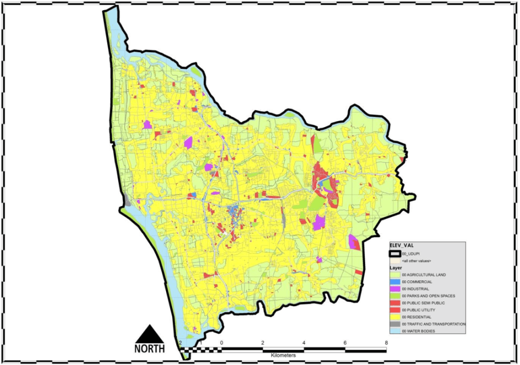
The focus of this study is the master plan for the city of Udupi, Karnataka in India. The master plan, which was developed by the Udupi Urban Development Authority (UUDA) and covers the year 2031, takes into account the current settlements within the planning area. This master plan was chosen as the subject of the study because Udupi has experienced organic growth over time. The master plan was obtained from the UUDA.
In this study, the principle of scarcity serves as the foundation for the analysis. A formula that calculates an inverse ratio is used to determine a value for each subset of land use in the study area. These values are then compared to global land use values to identify correlations.
The principle of Scarcity is based on the idea that resources are finite and that there is not enough of them to satisfy all human wants and needs. As a result, individuals, businesses, and societies must make choices about how to allocate these limited resources.

The principle of scarcity is a fundamental concept in economics and is the basis for the field of microeconomics, which studies how individuals and firms make decisions about the allocation of scarce resources. It is also a key factor in the operation of markets, as the demand for a good or resource is influenced by its availability. When a good or resource is in high demand but low supply, its price tends to increase, while when it is in low demand and high supply, its price tends to decrease.

The principle of scarcity has important implications for how individuals and societies make decisions about the allocation of resources and how they prioritize their wants and needs. It also has important implications for policy decisions related to resource allocation and distribution, such as taxes, subsidies, and regulations.
Methodology:
The first step in this study is to determine the overall distribution of each of the identified land use types within the development plan for the city. This will involve calculating global distribution values for each land use type. These values will provide a baseline for understanding the distribution of land uses within the city and will be used to assess the efficiency of the land use mix within specific areas of the city.

The “Land Use Value (i)” is derived using the formula below.
i.e. In the Case of iag , 100/30.89 = 3.237
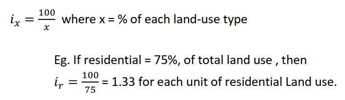
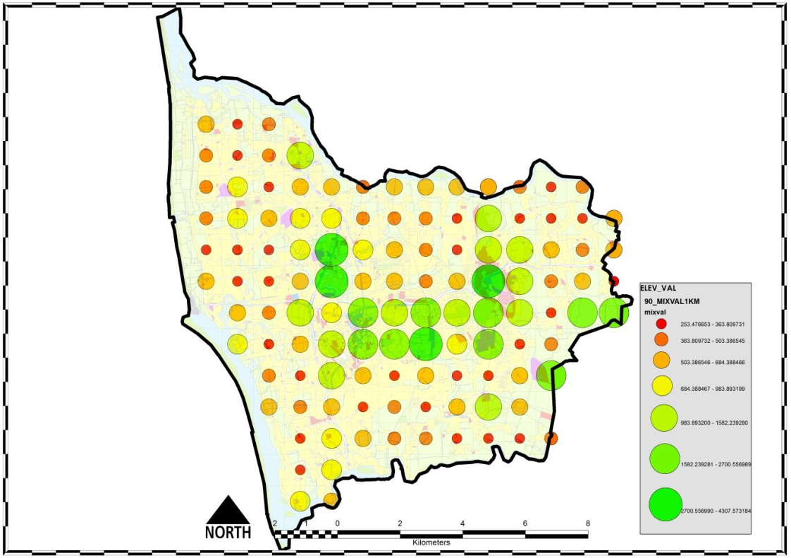
To proceed with the next analysis, divide the development plan or master plan into grids of a usable size. These grids will serve as new study areas where the values derived for each land use type can be applied to determine a value for each cell within the grid.
For each cell, determine the percentage of each land use present. Then, multiply these percentages by the values (i) calculated in table 1 to obtain the final values for each cell.
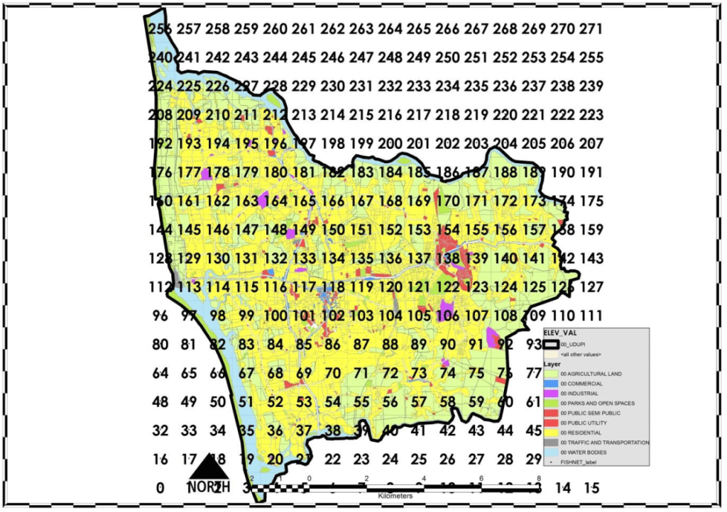
i.e. In the case of Cell 129, Residential Zoning (Yellow) occupies 60.71% of the area of the cell. i129 value for residential zoning can be derived as ir129 x ir (60.71 x 1.95 = 118.38). Similarly “i” values for each of the land uses are to be calculated and the final value is the sum of all the land use “i” values marked simply as i129.
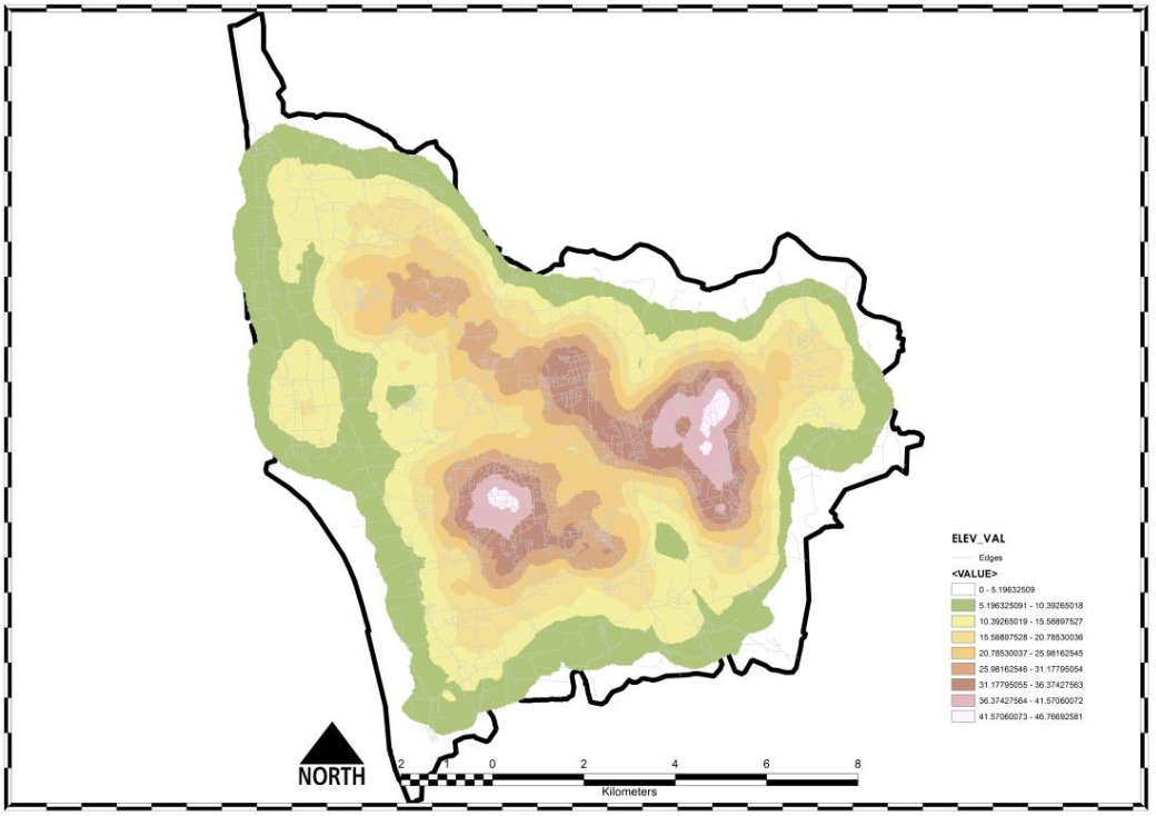
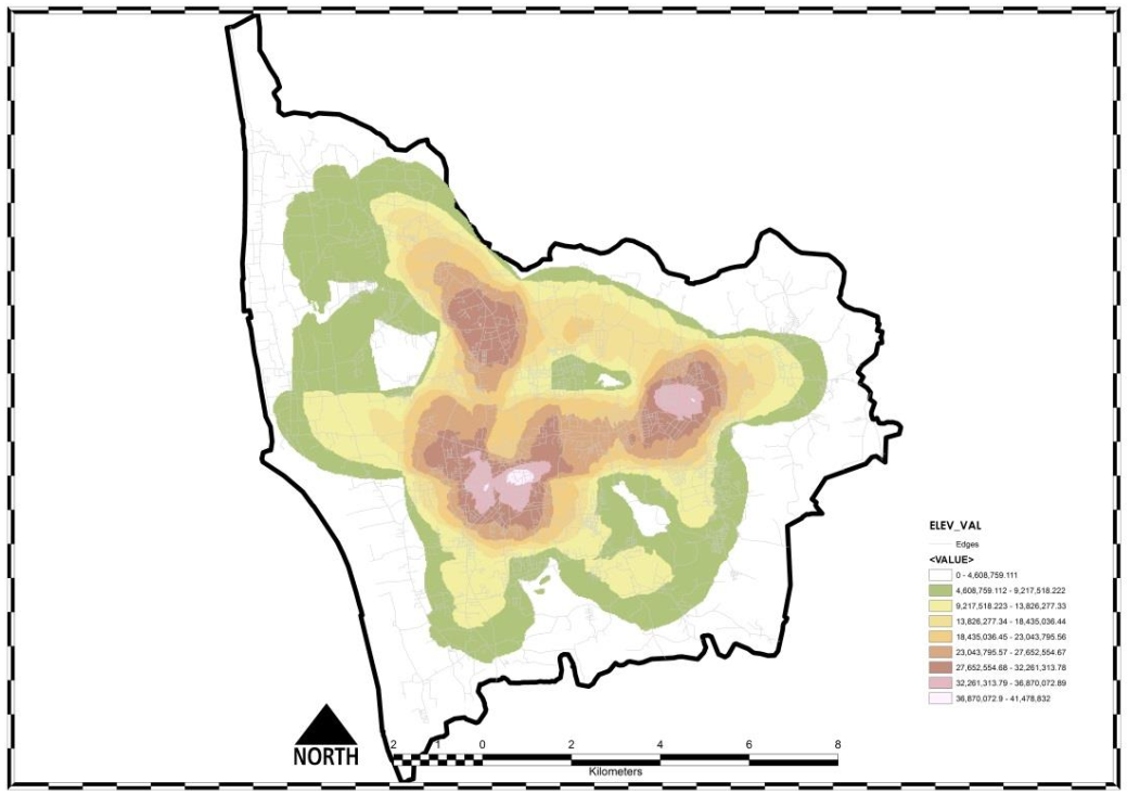
With these values calculated, they can be assigned to each cell and a visual map can be created that displays the values for each cell. This map can help to illustrate the distribution of values across the study area.

Correlations:

Concluding Statements:
The findings of this study suggest that the mix of land uses within an area tends to be highly correlated with the areas that residents identify with. The road network has evolved naturally over time in conjunction with the mix of land uses, and the results of the space syntax analysis support this observation.
The methodology used in this study is based on the existing physical characteristics of the study area, with the exception of cases where there has been a change in land use. It does not take into account factors such as road widths or the location of landmarks and nodes. However, as a spatial methodology, it does provide a broad overview of the potential impact of the mix of land uses in the master plan on development trends. It should be noted that the methodology does not consider the actual floor space available for construction, but rather the total land area available.
The values assigned to the various land uses in this study are derived from the master plan itself, so in theory, the methodology could be applied at any scale. However, any changes to the global distribution of land uses would affect the values assigned to the local distribution of land uses, and any changes made after the analysis process would require the values to be recalculated.
This study was completed as part of an urban design and development dissertation at Manipal University in 2016.
